File:2008 US Electoral College Polling Map.png
From Conservapedia
This is an old revision of this page, as edited by Karajou (Talk | contribs) at 16:26, November 18, 2008. It may differ significantly from current revision.
Size of this preview: 800 × 394 pixels. Other resolution: 320 × 158 pixels.
Original file (1,946 × 958 pixels, file size: 121 kilobytes, MIME type: image/png)
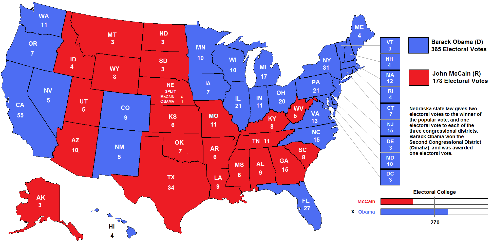
Polling map of the 2008 Presidential Election (current as of 18 November 2008)
self-made
File history
Click on a date/time to view the file as it appeared at that time.
| Date/Time | Thumbnail | Dimensions | User | Comment | |
|---|---|---|---|---|---|
| current | 22:55, November 19, 2008 | | 1,946 × 958 (121 kilobytes) | Karajou (Talk | contribs) | |
| 22:27, November 19, 2008 |  | 1,946 × 958 (111 kilobytes) | Karajou (Talk | contribs) | ||
| 22:20, November 19, 2008 |  | 1,946 × 958 (112 kilobytes) | Karajou (Talk | contribs) | ||
| 19:32, November 19, 2008 |  | 1,946 × 958 (113 kilobytes) | Karajou (Talk | contribs) | ||
| 16:26, November 18, 2008 |  | 1,946 × 958 (113 kilobytes) | Karajou (Talk | contribs) | Polling map of the 2008 Presidential Election (current as of 18 November 2008) self-made |
- You cannot overwrite this file.
File usage
The following page links to this file: