Death Valley
From Conservapedia
This is an old revision of this page, as edited by BrianCo (Talk | contribs) at 19:00, November 30, 2008. It may differ significantly from current revision.
This article is currently undergoing a major revision. Please do not edit this page until this template is removed.
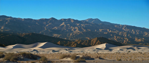
Death Valley is the lowest, driest and hottest part of the United States. It lies on the border between California and Nevada and has been designated as a National Park. Death Valley is 287 miles long and covers an area of about 3,000 square miles (7,800 km²).
The lowest point of Death Valley - Badwater Basin - is the lowest point in the United States at -282 ft (85.5 m) below sea level and is overlooked by Telescope Peak a mountain 11,049 feetTemperatures and Precipitation[1]
| Jan | Feb | Mar | Apr | May | June | July | Aug | Sep | Oct | Nov | Dec | Year | |
|---|---|---|---|---|---|---|---|---|---|---|---|---|---|
| daily high (average) |
65° F | 72° F | 80° F | 90° F9 | 9° F | 109° F | 115° F | 113° F | 106° F | 92° F | 76° F | 65° F | 90° F |
| 18° C | 22° C | 27° C | 32° C | 37° C | 43° C | 46° C | 45° C | 41° C | 33° C | 24° C | 18° C | 32° C | |
| daily low (average) |
39° F | 46° F | 53° F | 62° F | 71° F | 80° F | 88° F | 85° F | 75° F | 62° F | 48° F | 39° F | 62° F |
| 4° C | 8° C | 12° C | 17° C | 22° C | 27° C | 31° C | 29° C | 24° C | 17° C | 9° C | 4° C | 17° C | |
| record high | 89° F | 97° F | 102° F | 112° F | 122° F | 128° F | 134° F | 127° F | 123° F | 113° F | 97° F | 88° F | 134° F |
| 32° C | 36° C | 39° C | 45° C | 50° C | 53° C | 57° C | 53° C | 50° C | 45° C | 36° C | 31° C | 57° C | |
| record low | 15° F | 25° F | 30° F | 35° F | 42° F | 49° F | 62° F | 64° F | 41° F | 32° F | 24° F | 19° F | 15° F |
| -9° C | -4° C | -1° C | 2° C | 6° C | 10° C | 17° C | 18° C | 5° C | 0° C | -4°C | -7° C | -9° C | |
| precipitation | 0.27" | 0.35" | 0.25" | 0.12" | 0.08" | 0.04" | 0.11" | 0.10" | 0.14" | 0.11" | 0.18" | 0.19" | 1.94" |
| 0.7 cm | 0.9 cm | 0.6 cm | 0.3 cm | 0.2 cm | 0.1 cm | 0.3 cm | 0.3 cm | 0.4 cm | 0.3 cm | 0.5 cm | 0.5 cm | 4.9 cm |


